Severe thunderstorms are expected from central Texas to middle Tennessee and Kentucky this afternoon into tonight. Large hail and damaging winds are the main threats. Heavy to excessive rainfall may produce areas of flooding today and tonight from central Texas into the lower Mississippi Valley.
Overview
This page provides a variety of information related to the Missouri River, including river levels, reservoir data, snow pack information as well as weather forecasting information.
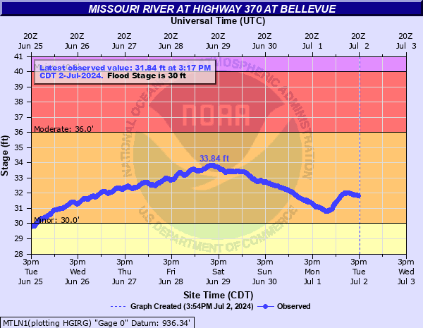
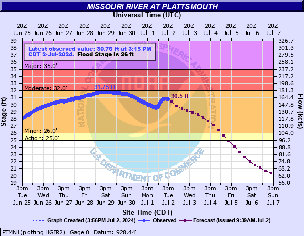
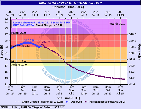
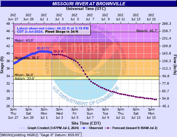
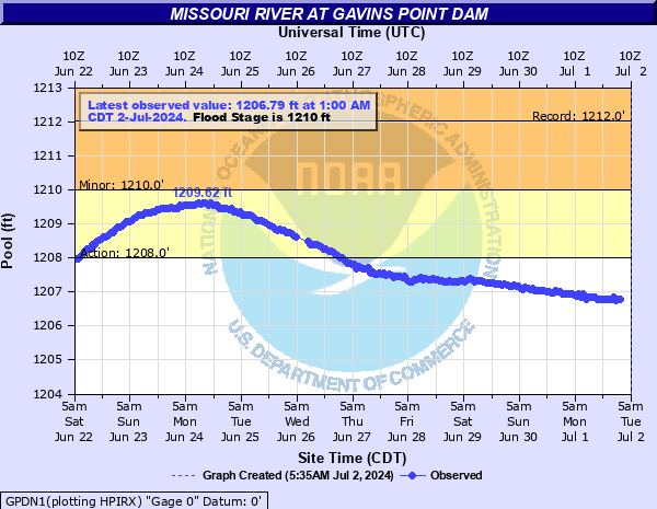
Missouri River Hydrographs
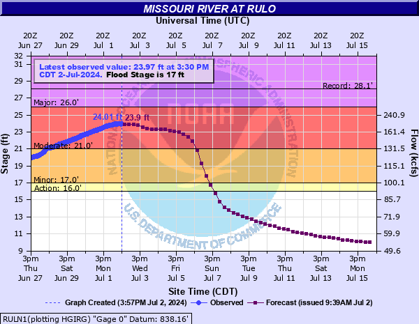
Click on a hydrograph to expand the image, click on the text below each image to see stage impacts and historic crests.
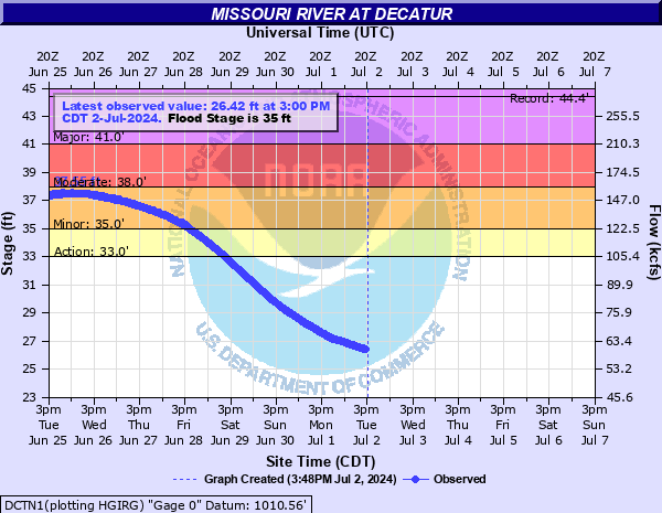
| Sioux City | Decatur |
|
|
|
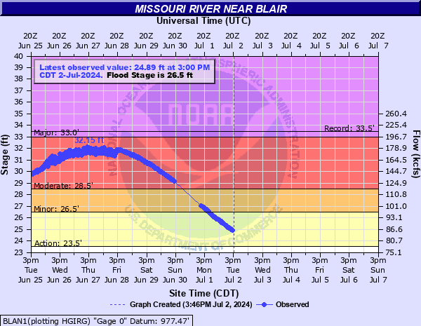
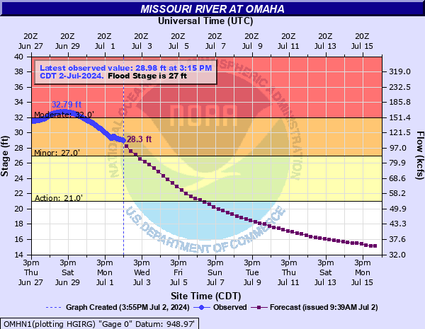
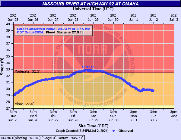
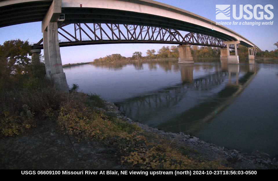
| Blair | Omaha |
|
|
|
|
|
|
|
Plattsmouth
|
Nebraska City
|
|
Brownville
|
Rulo
|
Click on a hydrograph to expand the image, click on the text below each image to see stage impacts and historic crests.
|
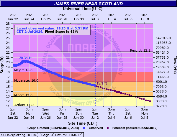
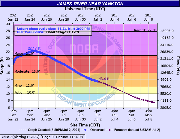
James River |
|
| near Scotland, South Dakota | near Yankton, South Dakota |
|
Click for full gage page |
Click for full gage page |
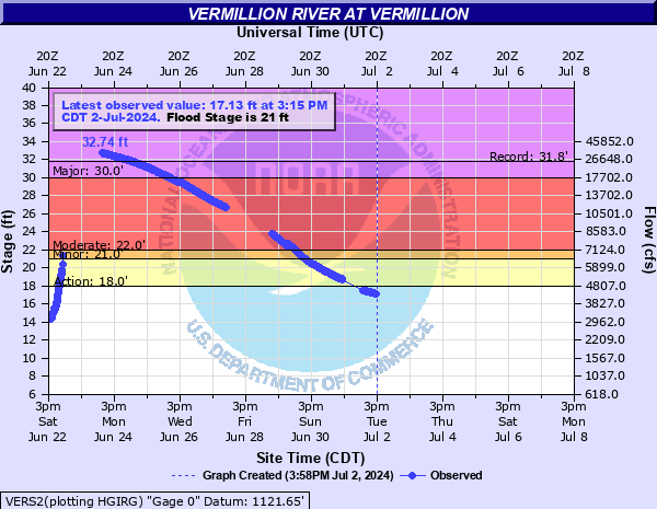
| Vermillion River | |
|
Click for full gage page |
|
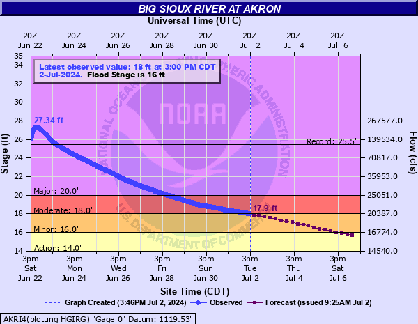
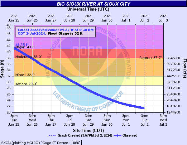
| Big Sioux River | |
| at Akron, Iowa | at Sioux City, Iowa |
|
Click for full gage page |
Click for full gage page |
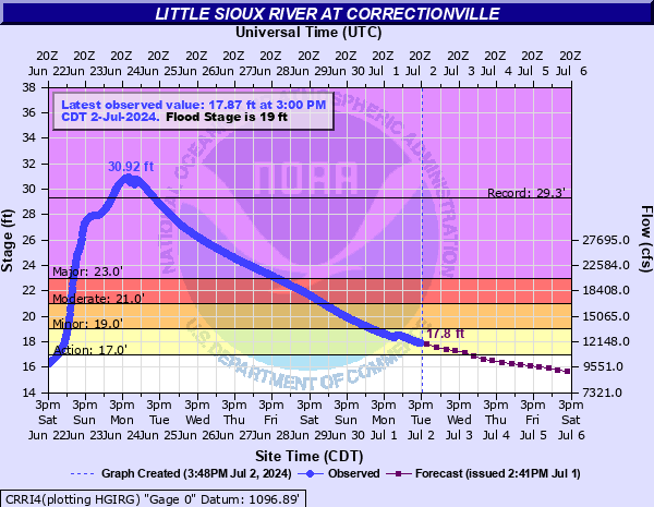
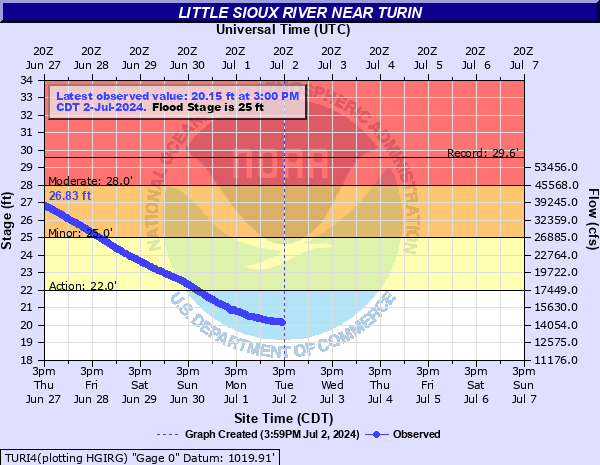
| Little Sioux River | |
|
at Correctionville, Iowa
Click for full gage page |
at Turin, Iowa
Click for full gage page |
|
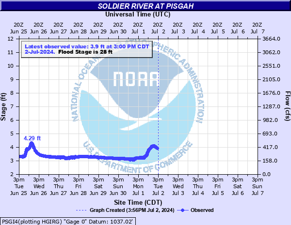
Soldier River at Pisgah, Iowa
Click for full gage page |
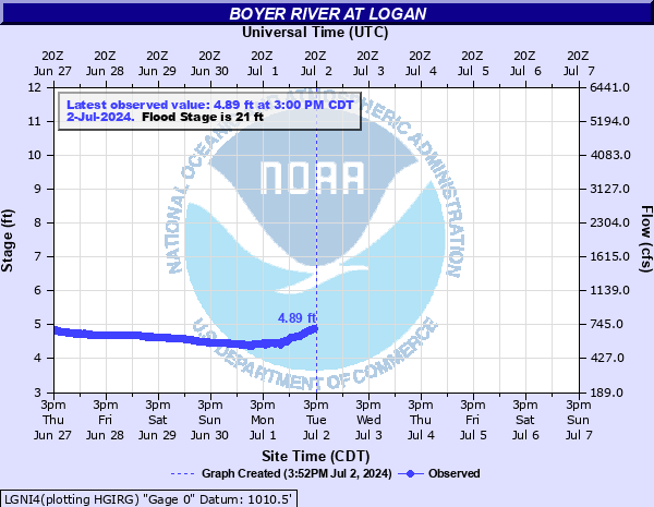
Boyer River at Logan, Iowa
Click for full gage page |
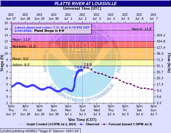
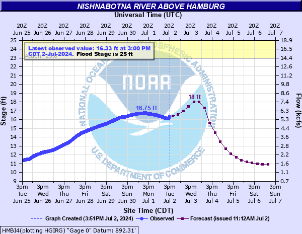
| Platte River | Nishnabotna River |
|
Click for full gage page |
Click for full gage page |
Short Range Temperatures:
Click Images to Enlarge
 |
 |
 |
 |
 |
 |
 |
 |
 |
 |
 |
 |
 |
 |
| Accumulated Freezing Degree Days | |
 |
|
Gavins Point:
(updated on Wednesday's)
|
|
(table format) |
|
Snow Depth
|
|
Snow Water Equivalent
|
Mountain Snowpack Water Content
|
Click Image to Enlarge
|
Precipitation:
Click Images to Enlarge
| Past 24 hours of Precipitation (Observed) | Past 7 days of Precipitation (Observed) |
 |
 |
| Expected Accumulation the next 24 hours | Expected Accumulation the next 48 hours |
 |
 |
| Expected Accumulation the next 72 hours | Expected Accumulation the next 7 days |
 |
 |
| 6 to 10 Day Precipitation Outlook | 8 to 14 Day Precipitation Outlook |
 |
 |
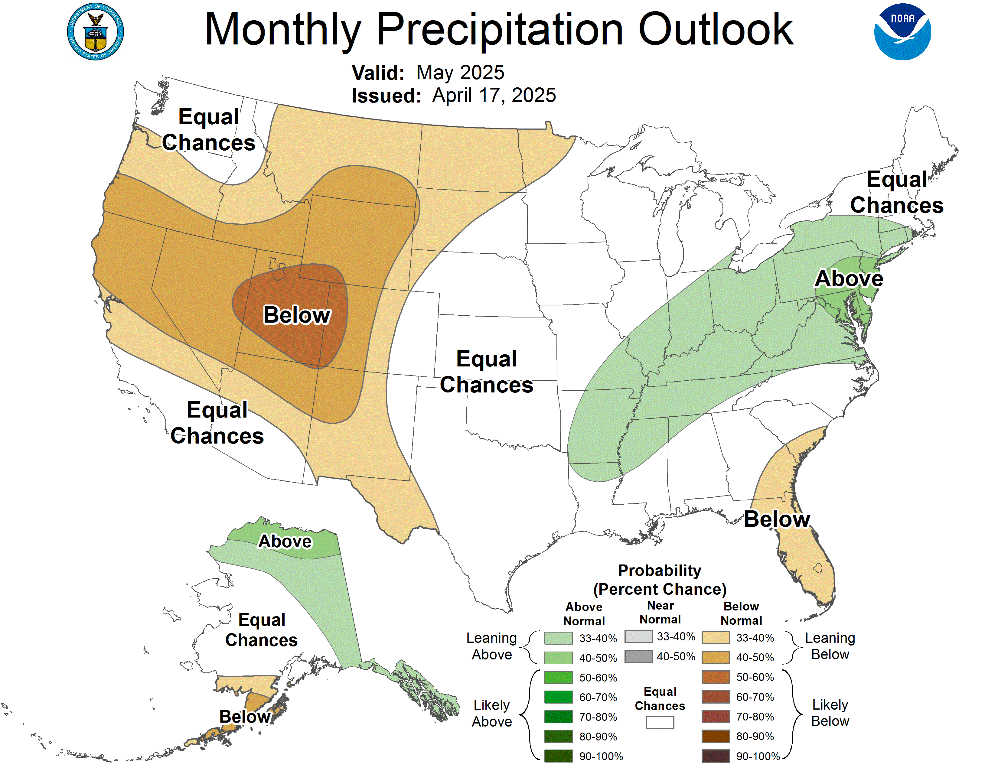
| One Month Precipitation Outlook | |
|
|
|
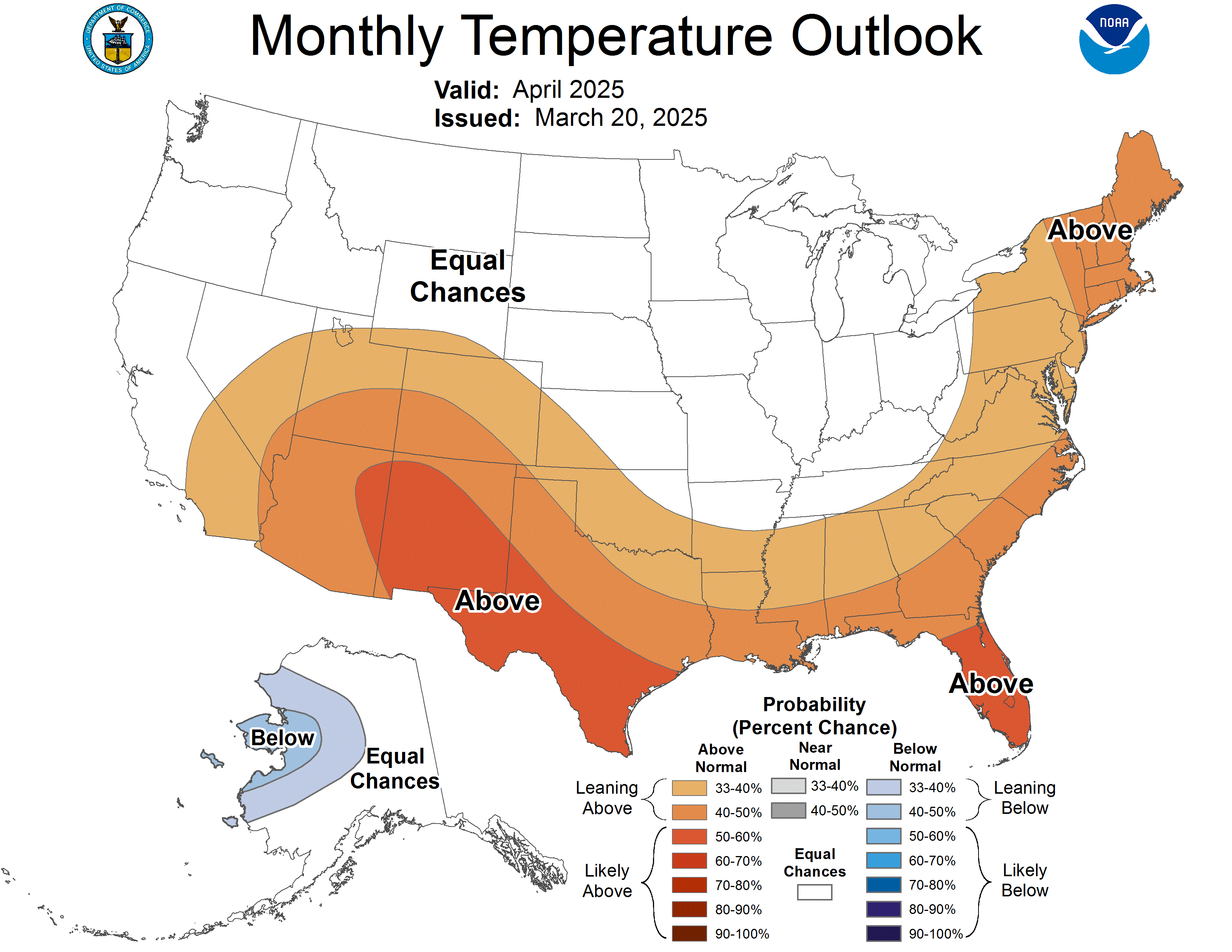
Long Range Temperatures
 |
 |
 |
 |
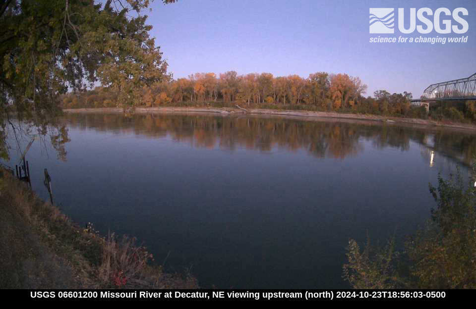
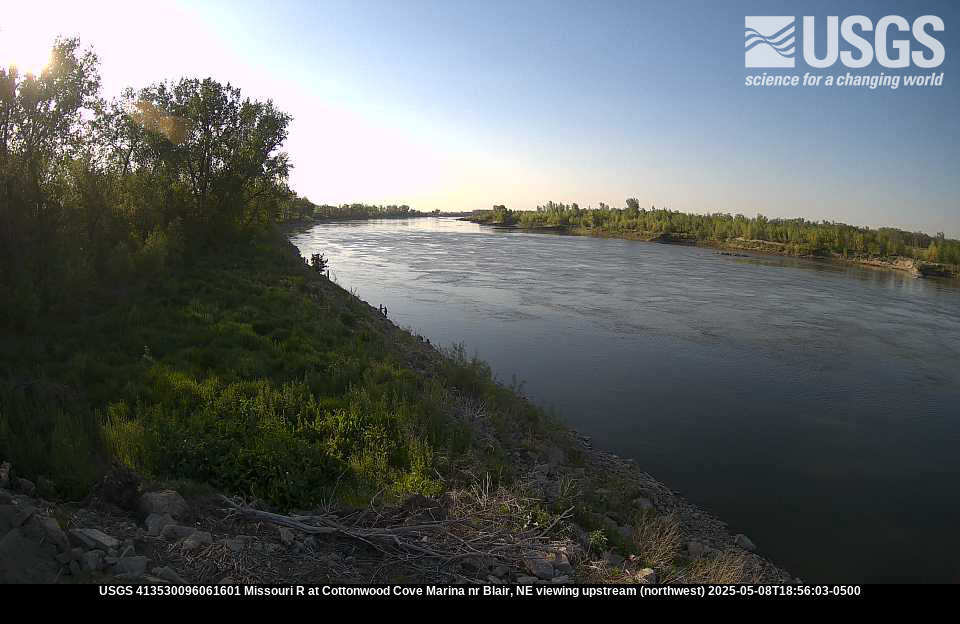
River Cameras (from )
These river cameras are courtesy of KTIV, Nebraska DOT, and the USGS. In addition, the Omaha Luminarium has a .
(I-680)

(I-480)
(I-80)

 |
Media use of 痔极郤 Web News Stories is encouraged! Please acknowledge the 痔极郤 as the source of any news information accessed from this site. |
|