Severe thunderstorms are expected from central Texas to middle Tennessee and Kentucky this afternoon into tonight. Large hail and damaging winds are the main threats. Heavy to excessive rainfall may produce areas of flooding today and tonight from central Texas into the lower Mississippi Valley.
Overview
This page provides a variety of information related to ice jam monitoring in eastern Nebraska, including river levels, snow pack information as well as weather forecasting information.
Platte River cameras (from )
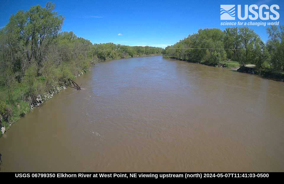
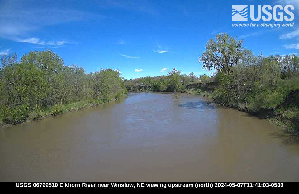
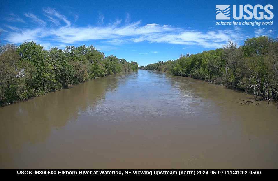
Elkhorn River cameras (from )
|
|
|
|
|
Temperature Outlook
Click Images to Enlarge
 |
 |
 |
 |
 |
 |
 |
 |
 |
 |
 |
 |
 |
 |
 |
 |
 |
 |
| Accumulated Freezing Degree Days | |
 |
|
Precipitation Outlook:
Click Images to Enlarge
| Past 24 hours of Precipitation (Observed) | Past 7 days of Precipitation (Observed) |
 |
 |
| Expected Accumulation the next 24 hours | Expected Accumulation the next 48 hours |
 |
 |
| Expected Accumulation the next 72 hours | Expected Accumulation the next 7 days |
 |
 |
| 6 to 10 Day Precipitation Outlook | 8 to 14 Day Precipitation Outlook |
 |
 |
| 3-4 Week Precipitation Outlook | One Month Precipitation Outlook |
 |
 |
|
|
|
Snow Information
Click Images to Enlarge
|
Snow Depth
|
|
Snow Water Equivalent
|
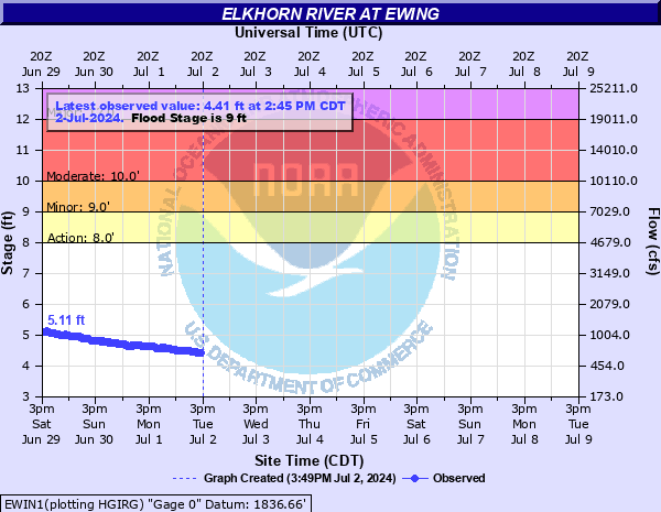
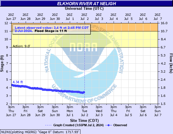
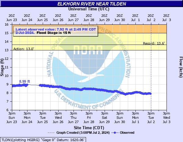
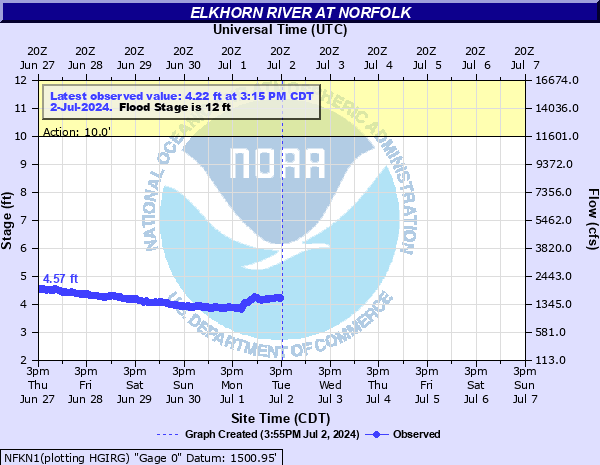
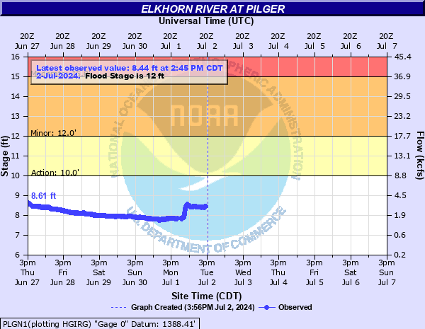
Elkhorn River Hydrographs
| Ewing | Neligh |
|
|
|
| Tilden | Norfolk |
|
|
|
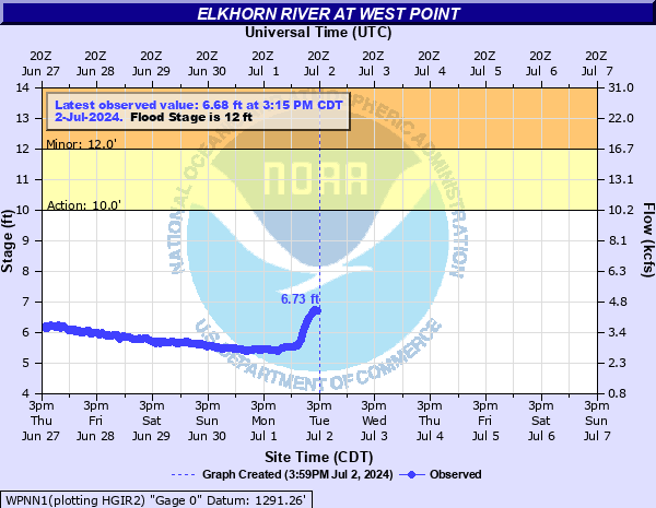
| Pilger | West Point |
|
|
|
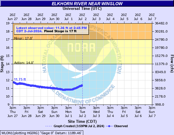
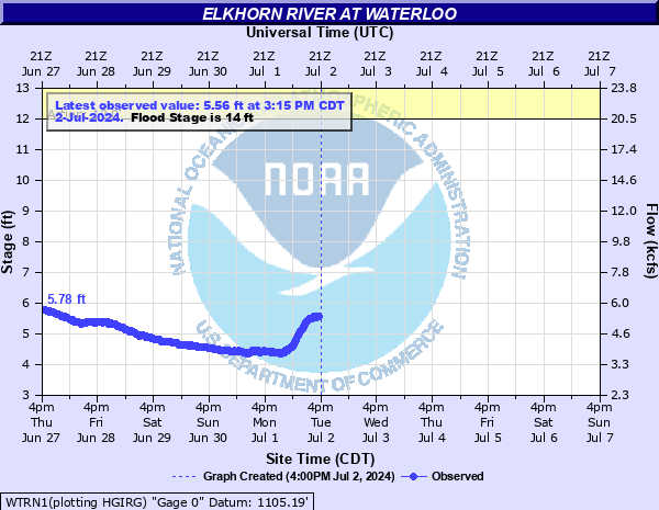
| Winslow | Waterloo |
|
|
|
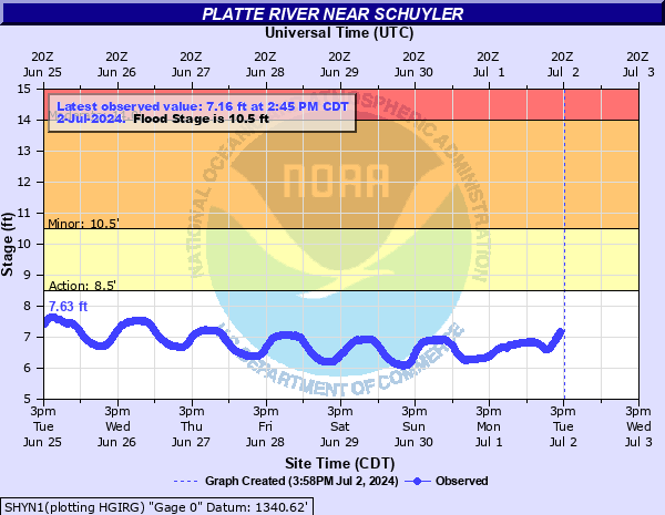
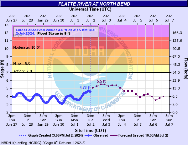
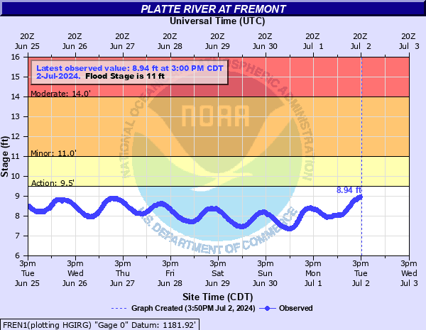
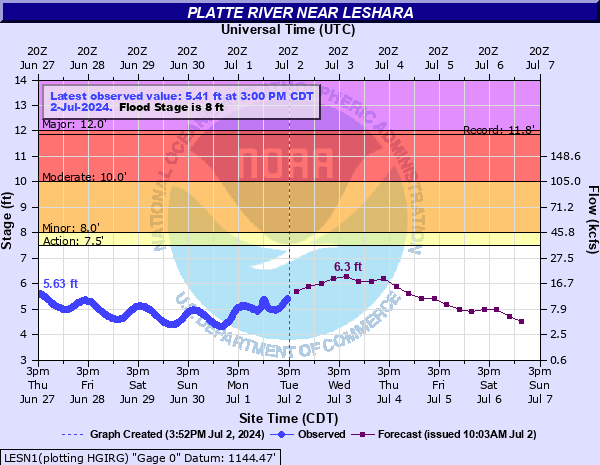
Lower Platte River Hydrographs
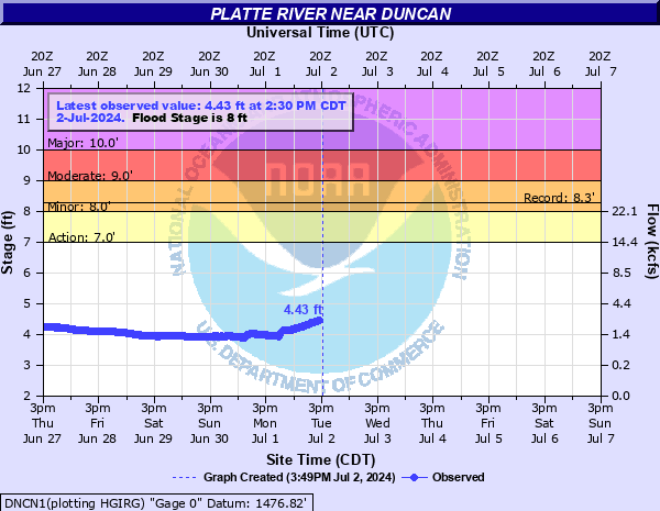
| Duncan | Schuyler |
|
|
|
| North Bend | Fremont |
|
|
|
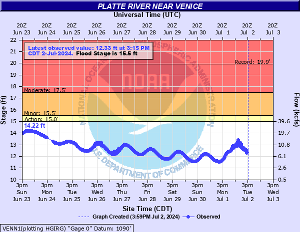
| Leshara | Venice |
|
|
|
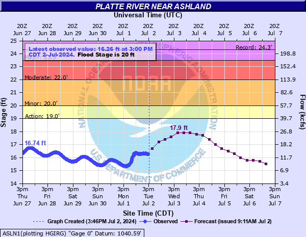
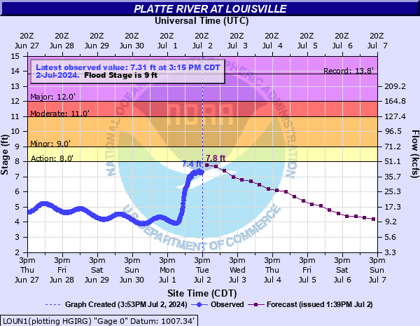
| Ashland | Louisville |
|
|
|
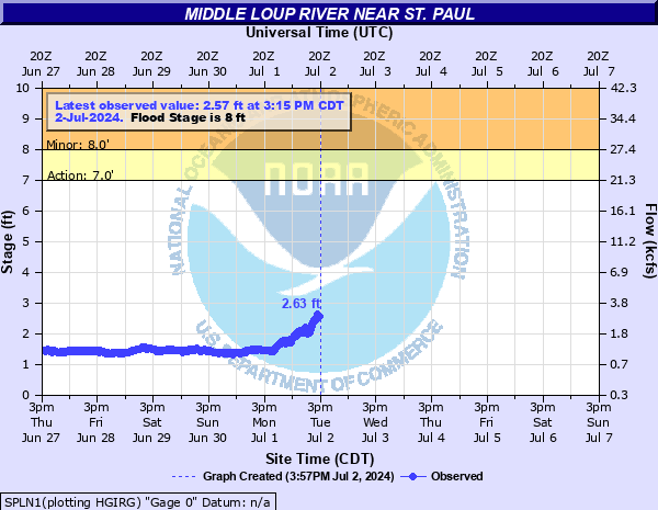
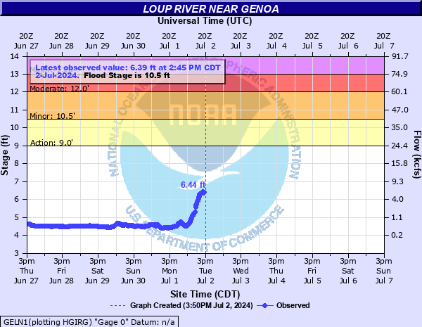
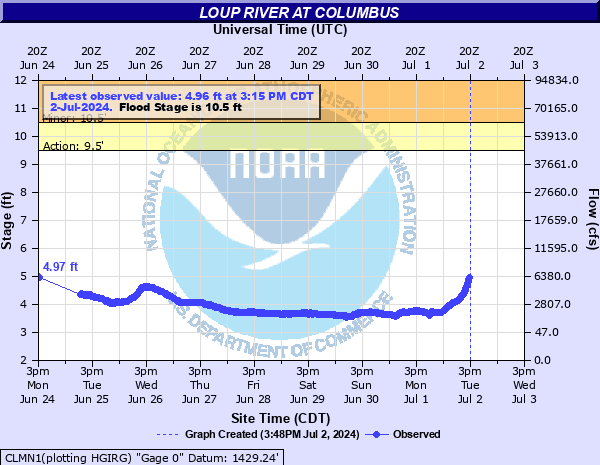
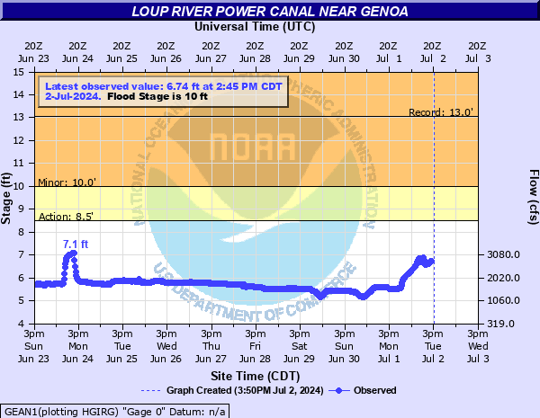
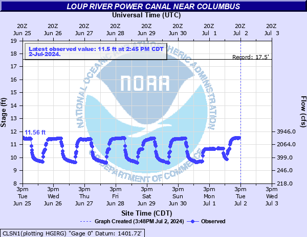
Loup River/Canal Hydrographs
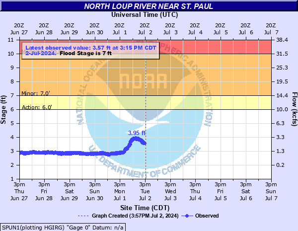
| St. Paul (North Loup) | St. Paul (South Loup) |
|
|
|
| Genoa | Columbus |
|
|
|
| Loup Canal (inlet/headworks) | Loup Canal (outlet/tailrace) |
|
|
|
 |
Media use of 痔极郤 Web News Stories is encouraged! Please acknowledge the 痔极郤 as the source of any news information accessed from this site. |
|