Possible Impacts: Going into drought: short-term dryness slowing planting, growth of crops or pastures. Coming out of drought: some lingering water deficits; pastures or crops not fully recovered
D1
Moderate Drought
Some damage to crops, pastures; streams, reservoirs, or wells low, some water shortages developing or imminent; voluntary water-use restrictions requested
D2
Severe Drought
Crop or pasture losses likely; water shortages common; water restrictions imposed
D3
Extreme Drought
Major crop/pasture losses; widespread water shortages or restrictions
D4
Exceptional Drought
Exceptional and widespread crop/pasture losses; shortages of water in reservoirs, streams, and wells creating water emergencies
U.S. DROUGHT OUTLOOKS
One Month Drought Outlook
Seasonal Drought Outlook (3 months)
DROUGHT TRACKER, VEGETATION, and QUICK DROUGHT INDICES FOR COLORADO
Westwide Drought Tracker
Vegetation Drought Response
Quick Drought Response Index
()
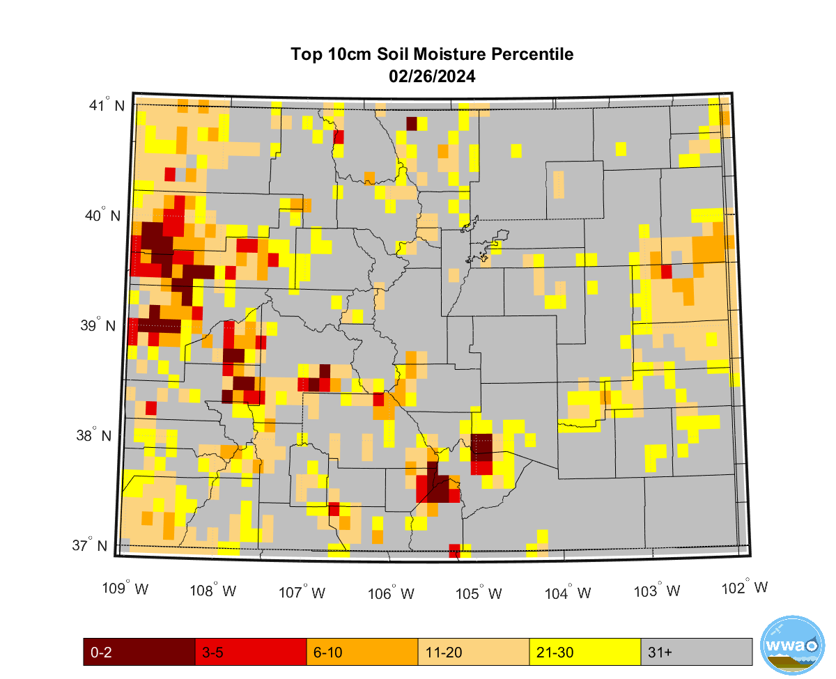
SOIL MOISTURE
10 cm soils in Colorado
()
top meter soils in Colorado
()
U.S. Soils, Crops & Drought
or
or or
or
or
or
or
- Colorado
3 month
6 month
12 month
% of Median
Basins & SNOTEL Sites
% of Median
River Basin only
% of Median
SNOTEL sites only
or
or
or
or
or
or
or
or
NRCS SNOWPACK SWE TIMESERIES GRAPHS (below or click here)
Statewide and Basins in North Central Colorado. SNOTEL sites
Subbasins in the
South Platte Basin
Subbasins in the North Platte Basin
and just West of the Divide