

Severe thunderstorms are expected from central Texas to middle Tennessee and Kentucky this afternoon into tonight. Large hail and damaging winds are the main threats. Heavy to excessive rainfall may produce areas of flooding today and tonight from central Texas into the lower Mississippi Valley.
Fort Worth/Dallas, TX
Weather Forecast Office
Drought Information
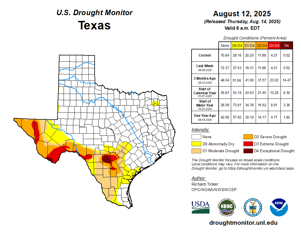
Much of North and Central Texas, especially west of the I-35 corridor, remains in a precipitation deficit so far this spring. With increasing odds for below normal precipitation through at least July, the likelihood that existing drought areas will persist or intensify into the drier summer months is increasing.
Current Drought Conditions

Fire Danger
With winter dormancy ongoing, any extended period without precipitation could reignite wildfire concerns. The days with the greatest potential for fire initiation and spread are those that are sunny and warm with low humidity and breezy winds. This potential will diminish with the onset of the spring growing season.
Even if a formal burn ban is not in effect for your area, it is still important to be vigilant about fire usage. Avoid open flames near dry vegetation, and assure all coals and embers are fully extinguished.

The is a drought statistic specifically designed to assess fire danger.
Drought Links
![]()
![]()
![]()
![]()
![]()
˛©ĚĺÓý
Fort Worth/Dallas, TX
3401 Northern Cross Blvd.
Fort Worth, TX 76137
817.429.2631
Comments? Questions? Please Contact Us.